Atmospheric Rivers Pacific Northwest: Rounds of Soaking Rain and Gusty Winds Slam the Region
A series of storms driven by atmospheric rivers Pacific Northwest will keep the region wet through mid-November. Washington and Oregon face repeated rounds of heavy rain and gusty winds, while British Columbia prepares for several feet of mountain snow, significantly increasing runoff and travel hazards.
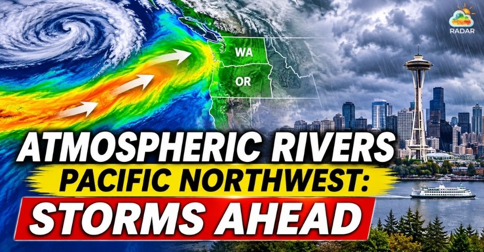
Atmospheric rivers Pacific Northwest
Atmospheric Rivers Pacific Northwest: Latest Updates
-
Repeated atmospheric rivers could bring significant rainfall to Washington and Oregon.
-
Saturated soils may increase the risk of river flooding, mudslides, and debris flows.
-
Gusty conditions could cause power outages and travel disruptions.
-
British Columbia's Coast Mountains could receive 10–20 feet of snow through November 14.
Multiple Atmospheric Rivers Set to Hit the Northwest
The Pacific Northwest is preparing for another round of unsettled weather as several atmospheric rivers move toward the West Coast between November 9 and 14.
These moisture-rich systems are expected to bring repeated precipitation to Washington, Oregon, and British Columbia, according to forecasts from the Center for Western Weather and Water Extremes (CW3E) and the National Weather Service (NWS).
The latest forecast points to at least two additional atmospheric rivers reaching the region early this week.
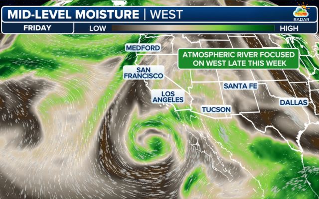
A powerful atmospheric river bringing high-density moisture directly into the West Coast (Photo: FOX Weather)
A third system is expected around November 9, followed by another on November 10. Their southwesterly flow could direct significant moisture toward the Olympic Peninsula and the North Cascades.
The NWS Weather Prediction Center forecasts 3–7 inches of precipitation across the Olympic Peninsula and Cascades between November 9 and 12.
Coastal Washington, Oregon, and Northern California could receive around 0.5–1.5 inches during the same period.
More rain is possible later in the week as another system approaches the coast.
Some forecast models also suggest atmospheric river activity could extend farther south toward Northern California between November 13 and 15.
What Is an Atmospheric River?
An atmospheric river is a long, narrow band of concentrated water vapor that transports moisture from the tropics and subtropics toward other regions. When it reaches land, it can produce prolonged heavy rain and mountain snow.
Saturated Ground, Coastal Winds and Mountain Snow Risks
Repeated rainfall could increase runoff across the region, especially where soils have already absorbed water from previous storms.
Small streams and rivers may rise as additional precipitation moves through the Northwest.
However, major river flooding is not currently expected across western Washington over the next seven days, according to the NWS Seattle forecast discussion.
The risk could change if a later atmospheric river stalls over the region and produces heavier rainfall than currently projected.
Forecasters also warn of possible mudslides and debris flows, particularly near wildfire burn scars.
Some coastal areas of British Columbia and western Washington could receive more than 1 foot of rain through November 14, although actual totals will vary by location.
Strong winds will add to the weather concerns.
Repeated storms could bring gusty conditions along the Pacific coast and through mountain passes, increasing the risk of falling trees, power outages, and travel disruptions.
Large waves and rough seas could also affect coastal communities and marine activities.
Follow incoming rain bands and precipitation intensity using the precipitation radar on RadarMap.
Mountain snowfall will be another major impact, particularly across British Columbia. Meteorologists forecast 10–20 feet of cumulative snow in parts of the Coast Mountains through November 14.
The heaviest snowfall could exceed 6 inches per hour in some high-elevation areas.
Farther south, snow in Washington's Olympic and Cascade mountains is expected to remain mostly limited to higher elevations.
Changes between rain and snow could increase runoff and make mountain slopes less stable, raising avalanche concerns.
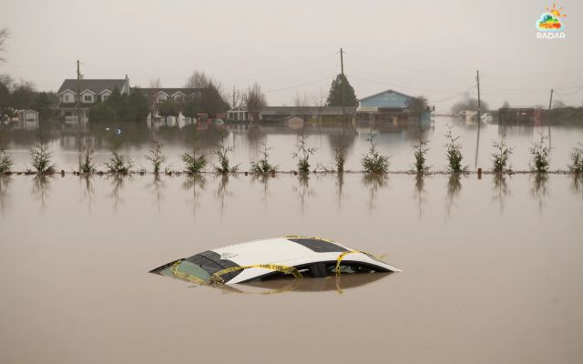
Repeated rainfall could increase runoff and flooding risks
The Pacific Northwest is unlikely to see a prolonged break from wet weather in the coming days.
Although a temporary lull is possible around midweek, another stronger system could move toward the coast later in the week.
CW3E forecasts additional atmospheric river activity across Washington, Oregon and Northern California between November 13 and 15.
NOAA also highlights the potential for heavy precipitation and strong coastal winds during this period, although the timing and intensity remain uncertain.
Residents should continue monitoring local NWS forecasts and weather alerts, especially in flood-prone areas, near wildfire burn scars and along mountain routes.
Conditions may change as the next systems move closer to the coast.
References
-
FOX Weather
-
Accuweather
-
Weather Nation TV


0 Comments
Leave a Comment
Your email address will not be published. Required fields are marked *