Late-Week Northeast Snow Storm Puts First Flakes in Sight
A Northeast snow storm could bring the first snowfall of the season to parts of the Great Lakes and inland Northeast between Thursday and Saturday, November 12–14. A developing low-pressure system may strengthen near the East Coast, bringing rain, snow and gusty winds. Meanwhile, colder Canadian air is expected to spread across the eastern US, increasing the potential for wintry weather.
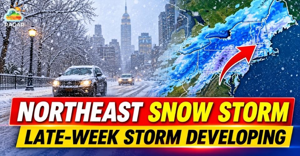
Northeast snow storm
Northeast Snow Storm Could Develop Into a Nor'easter
A changing weather pattern across the United States is setting the stage for a potentially active period in the Northeast.
A low-pressure system is forecast to move from the central US toward the Ohio Valley by Wednesday before approaching the Mid-Atlantic and East Coast later in the week.
The system could develop into a nor'easter as additional energy from Canada interacts with the approaching cold air.
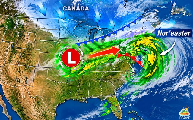
A developing storm could bring wintry weather to the East Coast late this week
However, its eventual path remains uncertain, leaving forecasters with different scenarios for the region.
One possibility involves the system traveling inland through the Ohio Valley and eastern Great Lakes before shifting its energy toward the Atlantic.
Another scenario suggests development closer to the coastline, which could increase wind and precipitation impacts in coastal areas.
The storm is expected to bring rain to parts of the eastern US from Thursday onward, with conditions potentially becoming more unsettled on Friday.
Its slow movement could extend precipitation into Saturday before the system moves toward Canada.
The exact storm track will determine where the heaviest precipitation develops and whether communities experience rain, snow or a mixture of both.
Read more: Storm on radar
Which Areas Could See Early Snow?
Not every part of the Northeast is expected to experience the same winter weather impacts. Current forecasts favor higher elevations and inland communities for the greatest chance of accumulating snow.
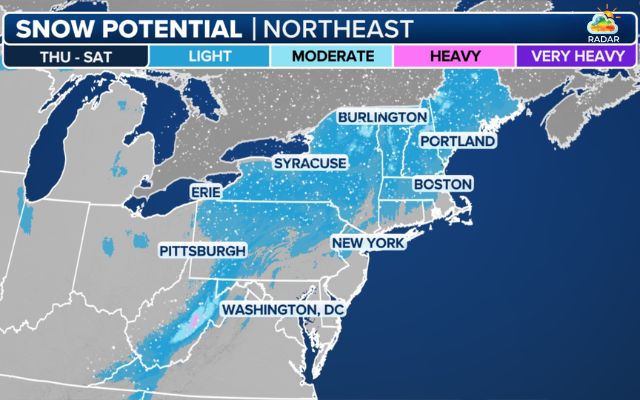
Snow forecast for the incoming week (Photo: FOX Weather)
Parts of Pennsylvania, New York and New England are among the areas to watch.
Pittsburgh, Syracuse and Binghamton could see their first snowflakes of the season. Higher terrain, including the Poconos, Catskills and Berkshires, also faces a risk of snowfall.
Northern areas such as Vermont, New Hampshire and Maine may have better opportunities for snow accumulation as colder air moves into the region.
By contrast, major coastal cities are likely to see more rain than snow. New York City, Philadelphia and Boston may remain too warm for meaningful snowfall, partly because of milder air coming from the Atlantic Ocean.
The difference between higher and lower elevations will also be important.
Even where snowflakes appear, temperatures near the ground may prevent accumulation on roads and other surfaces.
Check live precipitation and snow radar layers on RadarMap to track approaching precipitation and identify changes in the storm's movement.
Canadian Cold Front Signals a Major Temperature Shift
The storm is only part of the changing weather pattern.
A substantial push of colder air from Canada is expected to move across the eastern United States beginning late Friday, bringing a sharp contrast between temperatures in the East and West.
|
Region |
Temperature outlook |
|
Northeast |
Highs in the 30s–40s°F |
|
Great Lakes & Ohio Valley |
Colder conditions; freezing nights possible |
|
Tennessee & Alabama |
Near-freezing temperatures |
|
Northern Florida |
Colder conditions spreading south |
Afternoon highs across parts of the Northeast, Great Lakes and Ohio Valley could fall into the 30s and 40s°F, while overnight temperatures may drop into the 20s°F. Several consecutive nights of near- or below-freezing conditions are possible.
The cold air could extend farther south by Sunday, reaching portions of the Gulf Coast and Florida.
Cities such as Nashville and Knoxville in Tennessee, Huntsville in Alabama and areas north of Atlanta may also experience freezing temperatures.
These conditions could end the growing season in some central and southern communities that have not yet experienced a hard freeze this fall.
Meanwhile, the western US is expected to follow a different pattern.
Parts of California, the Great Basin and the Desert Southwest could remain warmer and drier, with temperatures running 10–20 degrees above average.
Forecasters will continue refining the storm's track, snowfall potential and temperature outlook throughout the week.
Residents across the eastern US should follow updated forecasts as the system develops.
References
-
FOX Weather
-
Accuweather



0 Comments
Leave a Comment
Your email address will not be published. Required fields are marked *