Mid-Atlantic Coastal Flooding Risk Grows Along East Coast
Mid-Atlantic coastal flooding threatens communities from North Carolina to New Jersey as a slow-moving nor’easter brings strong winds, large waves and beach erosion. Coastal flood alerts and hazardous surf could disrupt travel and threaten low-lying areas through the middle of the week. Here’s where conditions could worsen and what residents should watch.
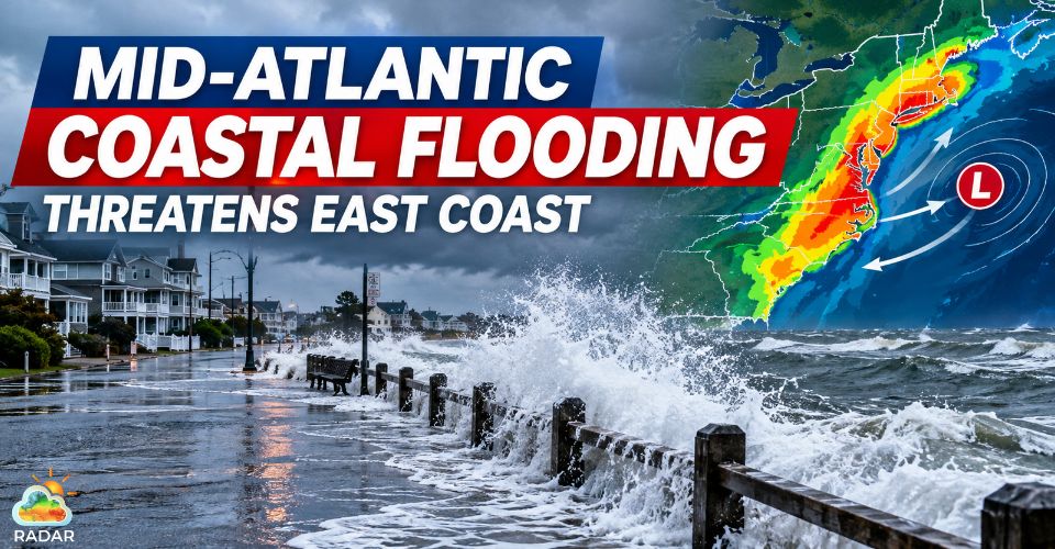
Mid-Atlantic coastal flooding threatens East Coast
Mid-Atlantic Coastal Flooding Threatens Vulnerable Shorelines
Coastal communities across North Carolina, Virginia, Maryland, Delaware and New Jersey are facing an elevated risk of flooding as the nor’easter moves along the Atlantic coast.
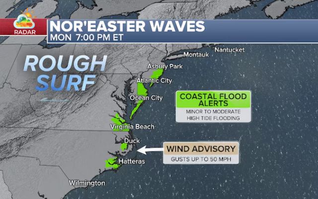
Coastal flood alerts were issued for October 19–20, with minor to moderate flooding possible in exposed areas.
Atlantic City, New Jersey, and Virginia Beach, Virginia, are among the locations at risk, particularly during high tide.
Persistent winds blowing toward the shore can push seawater inland, raising water levels even when heavy rain is limited.
North Carolina’s Outer Banks are also vulnerable. Dare County ordered visitors to leave Hatteras Island as dangerous coastal conditions threatened access routes.
Ocean overwash could affect sections of NC Highway 12, a key road connecting communities along the barrier islands.
High tides and onshore winds raise flood risks across the East Coast (Photo: ABC News)
Travelers and residents can check rain and wind patterns on GoWeatherRadar’s interactive radar map to monitor approaching weather and plan around changing conditions.
Radar imagery should be used alongside official coastal flood alerts, since it does not directly show storm surge or seawater flooding.
Nor’easter Brings Damaging Gusts and Rough Surf to Shorelines
Strong northeast winds and persistent ocean waves are expected to drive much of the coastal disruption.
It is forecast that sustained winds of 25–35 mph in parts of coastal Virginia and North Carolina, with gusts reaching 50 mph.
Gusts could reach 40–60 mph from near Morehead City, North Carolina, to Atlantic City, New Jersey, with isolated gusts potentially approaching 70 mph.
Breaking waves could reach 9–12 feet along parts of the Outer Banks and the Delmarva Peninsula.
These conditions can accelerate beach erosion, damage dunes and push seawater onto low-lying roads and properties.
Repeated high tides may compound the problem, allowing water to accumulate before previous flooding has fully receded.
Rough surf and rip currents also create dangerous conditions for swimmers and beach visitors.
People near the coast should avoid exposed beaches, flooded roads and areas with breaking waves.
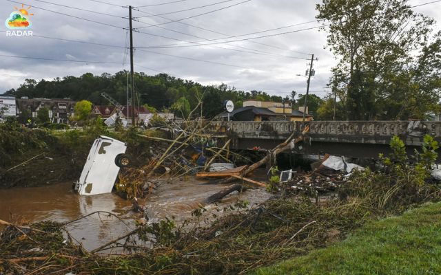
Strong winds and powerful waves threaten beaches and coastal roads
When Could Coastal Flooding Conditions Improve?
The nor’easter is expected to remain a concern through at least the middle of the week, with coastal hazards potentially extending farther north toward Long Island, Rhode Island and Massachusetts later in the week.
The exact duration of flooding will depend on the storm’s track, wind direction and timing of high tides.
Even as the system changes position, persistent onshore winds and rough surf could continue to affect beaches and low-lying coastal areas.
Forecasters are also watching whether the system could develop tropical or subtropical characteristics over the warm Gulf Stream.
However, this remains a possibility rather than a confirmed outcome. Strong winds, rough seas and coastal flooding remain the primary concerns.
Residents should monitor updates from the National Weather Service and local emergency officials.
Conditions can vary significantly between neighboring communities, so local warnings remain essential even as the broader storm begins to move away.
|
Flood Safety Tips
|
References
-
ABC News
-
New York Times
-
Accuweather





0 Comments
Leave a Comment
Your email address will not be published. Required fields are marked *