Magnitude 6.5 Earthquake Shakes Alaska's Aleutian Islands
A magnitude 6.5 earthquake struck the waters off Alaska's remote Aleutian Islands early Thursday, Sept. 17. The earthquake was recorded about 103 miles west of Nikolski at a depth of approximately 69 miles. The National Tsunami Warning Center said no tsunami threat was expected, while early assessments indicated no major damage or casualties. Seismologists continue to monitor the region for additional activity.
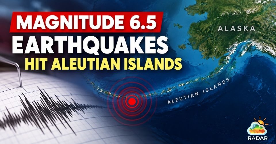
Magnitude 6.5 earthquake struck off Alaska's Aleutian Islands
Strong Earthquake Recorded Deep Beneath the Aleutians
A deep magnitude 6.5 earthquake shook the waters near Alaska's Aleutian Islands early Thursday, according to the U.S. Geological Survey (USGS).
The event occurred along one of the most seismically active zones in the United States.
The National Tsunami Warning Center issued an information statement shortly after the earthquake. The center reported that there was no tsunami warning, advisory, watch, or threat in effect following the event.
The earthquake occurred at approximately 5:19 a.m. local time. USGS data placed the epicenter around 165 kilometers, or about 103 miles, west of Nikolski on Umnak Island, with a depth of roughly 69 miles.
The USGS assigned the event a green Pager alert, indicating a very low estimated likelihood of significant casualties or economic loss.
Because the earthquake originated deep underground and away from heavily populated areas, the strongest shaking was largely confined to a sparsely populated part of the Aleutian region.
EARTHQUAKE SAFETY TIPS: HOW TO STAY SAFE AFTER STRONG SHAKING
-
Inside a building: Drop, Cover, and Hold On. Take shelter beneath a sturdy table or desk and protect your head and neck until the shaking stops.
-
Outside: Head toward a clear area away from buildings, utility lines, trees, and unstable structures that could fall during or after an earthquake.
-
Along the coast: Strong or prolonged shaking can be an important warning sign. Move inland or to higher ground if you feel significant shaking and local officials issue evacuation guidance.
The broader Aleutian region is home to only a small and widely dispersed population. U.S. Census Bureau data estimates roughly 8,700 people live throughout the surrounding territory.
Reports submitted through the USGS "Did You Feel It?" system remained limited. By Thursday afternoon, only six reports had been recorded from Atka, Unalaska, and Adak.
These communities are located roughly 144 to 245 miles from the earthquake's epicenter, and reported shaking was generally described as weak or light.
Track local conditions with live weather radar for Unalaska.
Initial information from the National Tsunami Warning Center listed the earthquake at magnitude 6.3.
The preliminary bulletin placed the event about 45 miles northeast of Amukta Pass and at a depth of approximately 52 miles.
Earthquake parameters can change as additional seismic data become available.
The USGS later listed the event as magnitude 6.5, with the epicenter approximately 165 kilometers west of Nikolski and a depth of about 83 kilometers.
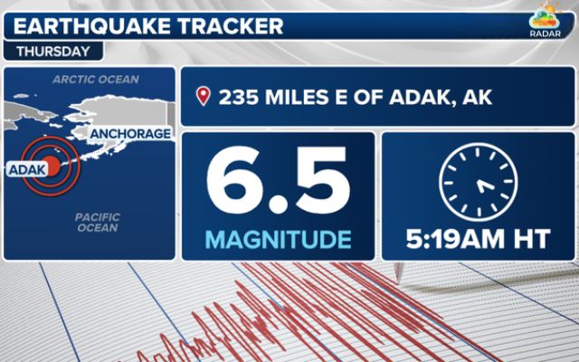
A magnitude 6.5 earthquake struck near Alaska's Aleutian Islands on Thursday (Source: FOX Weather)
Thursday's earthquake comes less than two weeks after another significant earthquake was recorded in the same general region.
On Sept. 3, the USGS recorded a magnitude 6.3 earthquake about 84 kilometers south-southwest of Nikolski.
That event occurred at a much shallower depth than Thursday's earthquake and was followed by numerous smaller seismic events in the surrounding area.
The earlier activity was associated with a cluster of earthquakes near Nikolski, while Thursday's earthquake occurred farther west and substantially deeper beneath the region.
Why Earthquakes Are Common in the Aleutian Islands?
The Aleutian Islands form part of the Pacific Ring of Fire, where major tectonic plates interact beneath the ocean and surrounding land.
In Alaska, the Pacific Plate is forced beneath the North American Plate along the Alaska-Aleutian subduction zone.
This tectonic boundary produces frequent earthquakes, including some of the largest seismic events ever recorded in the United States.
USGS research describes the Alaska-Aleutian system as one of the world's most active subduction zones.
The region has experienced several powerful historical earthquakes.
A magnitude 8.6 earthquake struck the Andreanof Islands in 1957, while a magnitude 8.7 earthquake occurred near the Rat Islands in 1965.
The Andreanof Islands form part of the central Aleutian chain between the Bering Sea and the North Pacific. Farther west, the Rat Islands extend along another section of the same active tectonic arc.
Alaska's seismic history also includes major tsunami events.
The magnitude 9.2 Great Alaska Earthquake of 1964 generated destructive waves and caused 122 deaths, with many fatalities linked to local landslide-generated surges.
Another dramatic example occurred in 1958, when an earthquake-triggered rockslide entered Lituya Bay.
The resulting wave reached an estimated height of 1,720 feet, making it one of the largest tsunami-like waves ever documented. Five people were killed.

Magnitude 9.2 Great Alaska Earthquake of 1964
While Thursday's magnitude 6.5 earthquake did not produce a tsunami threat, the event highlights the persistent seismic hazards across Alaska's Aleutian Arc.
The USGS and tsunami authorities continue to monitor the area for further earthquakes and potential changes in conditions.
References
-
FOX Weather
-
USA Today
-
NTD News





0 Comments
Leave a Comment
Your email address will not be published. Required fields are marked *